Putting Burlington’s Wildlife on the Map
By: Sophie Mazowita.
It’s not just the skiers who are eagerly awaiting snow; wildlife trackers across Burlington are counting down the days until the blanket of white makes our lawns and woods come alive with the trails of our wild neighbors. The morning after that first snowfall sends me running out to my backyard to see who’s been making the rounds: a skunk making multiple trips between my back doorstep and the den under my shed; a neighbor’s cat on the prowl; opossum crossing the driveway; or gray fox visiting the compost pile are often among the first sightings. Suddenly a whole night’s worth of wildlife activity is laid out in the tracks.
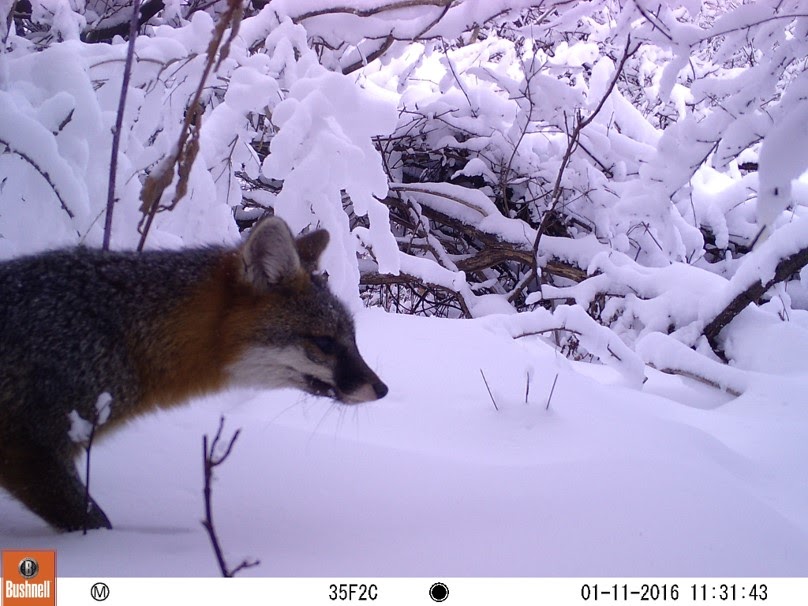
Beyond just offering a glimpse into the lives of secretive, nocturnal animals, these tracks are helping city planners and conservationists identify wildlife corridors and habitat. For two years, volunteers with the Burlington Mammal Tracking Project have been collecting photos and sightings of 12 large mammal species (mainly through tracks and sign) to create a map of Burlington wildlife. These observations are painting a picture of how large mammals move about the city and where they find core habitat (areas where there’s sufficient shelter and food for them to forage, den and breed in that area). The project focuses on species that are more sensitive to human disturbance than the skunks, opossums and raccoons that will comfortably stroll the city streets by night; they include red fox, gray fox, coyote, bobcat, fisher, otter, mink, beaver, moose, deer, black bear, and porcupine.
Sightings are collected through an online citizen science tool and smartphone app called iNaturalist, and they currently number over 500. A glance at the latest map shows otter, mink and beaver along the Lake Champlain waterfront, the Winooski River, and Centennial Brook, with mink also traveling the shorelines of smaller streams. Red fox, gray fox, and deer sightings abound in Burlington’s open spaces, including many of the narrow forest strips and vacant lots that are not frequented by people or pets. Coyotes are a little more sensitive to human presence but do travel the Intervale and Rock Point-Leddy Park area. Fisher and bobcat are among the rarest sightings, sticking to larger blocks of open space. Black bear hasn’t been spotted within City boundaries in the last 20 years, but they may occasionally travel along the Winooski River corridor. A porcupine was spotted in the Intervale this past October but is not yet represented on the map.
![]()
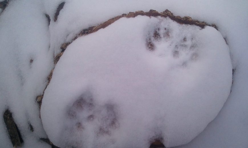
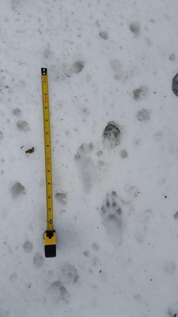
Points on the map only tell part of the story, though; it’s the lines that connect those dots that can be the most revealing, and that’s where tracking and trailing really come into play. On April 2nd last spring, after a final tease of April Fool’s Day snow, I found myself surrounded by fisher tracks (Martes pennanti, member of the family including ermine, mink and long-tailed weasel) in the woods on the east side of Oakledge Park. It was my first time exploring this area, and clearly the fisher had been exploring it, too: the tracks circled and crisscrossed each other as the animal visited the base of large trees and hollowed-out stumps, touching every side of the wooded perimeter but never venturing beyond the trees. This animal was on the hunt, maybe for food, maybe for a mate- or both.
Racing the melting snow, I searched for the trail that had brought the fisher into this 8-acre patch of forest, and that journey took me through the 100-ft wide strip of woods wedged between Austin Dr and the Ledgewood condos, across Austin Drive near someone’s driveway, and then into the narrow strip of trees behind Rhino Foods and the Green Mountain Transit garage off of Industrial Parkway. I lost the trail in patchy snow near the Red Rocks condos but expect that this fisher had come from Red Rocks Park.
Central to this animal’s movement- and to its ability to find habitat in our city- are the narrow strips of remnant forest that fringe condos, businesses, and industrial development. This fisher crossed multiple property boundaries as it traveled through a wooded corridor that seems too small, too surrounded by development, to be significant. I also found red fox and gray fox tracks in those woods that day, and there are records of deer and moose using this same corridor to travel across the city. Rhino Foods recently cut away part of this corridor as part of their industrial expansion, illustrating the uncertainty around protection of these wildlife corridors. Once the wildlife was brought to their awareness, they made a commitment to make restoration plantings and to make their incoming fencing wildlife-friendly, with gaps between the panels for easy passage. These types of small actions could make all the difference in keeping our city home to animals like the fisher.
A city full of connected wildlife corridors would benefit not just these large, wide-ranging mammals but also the many smaller creatures that share those spaces- and who may be shifting their ranges along with shifting climate. A connected green space network would also mean that all the human residents of Burlington would have green space nearby, benefiting from a place to sit in their local woods, a view from a window, cleaner air and waterways, or a chance to connect with the wild inhabitants who pass often-unnoticed through our backyards.
The tracking project is ongoing, with many areas yet to be surveyed and many stories yet to be discovered. Visit trackingVT.org to learn more about the project, view wildlife videos, or join a tracking outing.