Bedrock to Birds: Wildlands of Burlington and Beyond
A Journey Through the Wild Landscapes of Burlington
By Chris Ajello and Alicia Daniel
To develop intimacy with people it is necessary to understand their history; the same holds true for developing an intimate relationship with place. – Tom Wessels, 2012
Strangely enough, Burlington’s natural history can be told by oceans: their opening, their closing; their patterns of habitation and sedimentation; their in-rush and out-rush; and their transposition on land as glacial ice. While all life on earth is thought to originate from oceans, Burlington’s rich and diverse landscape exposes connections more direct and proximal. Excellent examples of this are the Champlain Thrust Fault at Rock Point and the deep delta sands underlying Starr Farm Park, both of which originated from separate bodies of saltwater. And these links to distant oceans and deep time are more than just curiosities, they’re foundational to translating what we see around us, to appreciating the wilds of Burlington. In this two-part series, we will examine the natural and cultural history of Burlington from the ground up, first by exploring its geology and soils, and later by integrating its plants, animals, and human inhabitants.
Watch The Video
A brief overview of Burlington’s geological history
Two immense collisions structure Burlington’s geological past. The first of these collisions occurred roughly 440 to 470 million years ago, a time when the ancient Adirondacks were an equatorial range along the southern coast of what would become North America, then known as Laurentia. The Atlantic had not yet formed, and the rocks undergirding present-day Burlington were still deep under the Iapetus Ocean–an ancient body of water that once stretched between the proto-American and the proto-European continents. Initially, the Iapetus Ocean was shallow and sandy, teeming with coral reefs and shellfish; later it deepened, and its bottom turned to mud. This pattern is recorded in layers of rock: sediments from the shallow, sandy ocean turned to ancient limestones and sandstones, while the sediments from the deep, muddy ocean turned to younger mudstones.
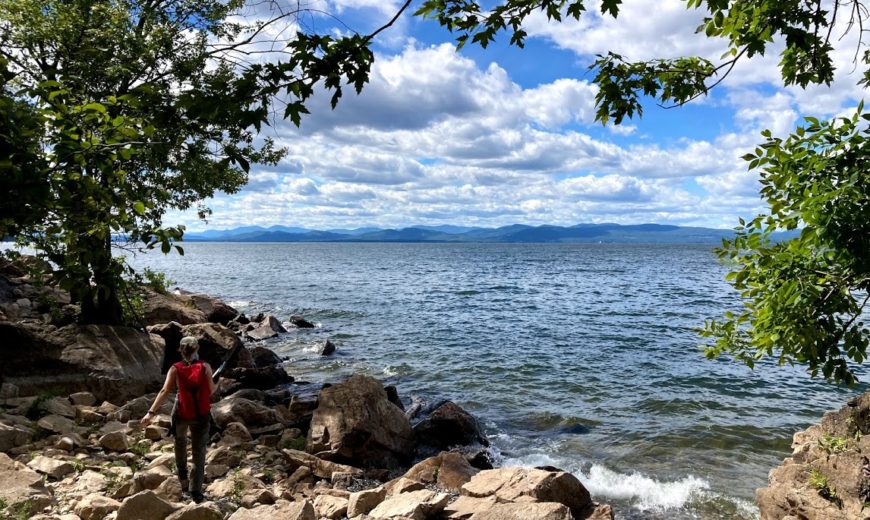
This is important because when the Iapetus Ocean finally began to close, these layers of sandstone, limestone, and mudstone came to define that first immense collisions: driven up from the depths, these layers of rock rode over the edge of the proto-North American continent and were bent, deformed, cracked, dragged, and broken apart; the collision was so powerful that it welded these ocean rocks to the edge of the Adirondacks, right where Lake Champlain now lies; what’s more, it created the thrust fault defining the western edge of Burlington, seen at the ledges of Ethan Allen Park and through Arms Forest, Rock Point, and Oakledge. A second collision followed roughly 100 million years later—355 to 385 million years ago—when an arc of islands smashed into the proto-North American coast. And it was this collision that lofted the Green Mountains from those layers of mudstone, turning them to the schist bedrock that defines the edges of the the Champlain Valley today.
Considerations of bedrock
This story of past upheaval is profoundly connected to the present Burlington landscape by oceanic mudstones, sandstones, and limestones. Each layer has distinct chemical structures and compositions, which determines how they break down over time. Under these broad categories, there are several specific types of rock that are of particular relevance here: quartzite, a metamorphosed sandstone; schist and shale, which are variably metamorphosed mudstone; and dolostone, a modified limestone, often derived from ancient sea-shells and coral reefs.
Quartzite, much like granite, is highly resistant to weathering. This means it contributes little to the surrounding soils. And Monkton Quartzite can be found at rocky sites throughout Burlington, like Red Stone Quarry and Oakledge Park, as well as just south of Burlington in Red Rocks Park. Notably, it was also used to build the tower at Ethan Allen Park, giving it a distinctive reddish-purple hue.
Schist, which dominates many of the bedrock deposits throughout the central and northern Green Mountains, is likewise a highly resistant rock; however, the related shale is more vulnerable to weathering—and in certain cases, this means that shale deposits can enrich surrounding soils with vital plant nutrients, like calcium. Iberville Shale is on full display at Rock Point–in the white-striped pebbles on the beach and in the striking rock layer undergirding the thrust fault itself. It also sustains the fertile pastures, croplands, and hardwood forests at Shelburne Farms.
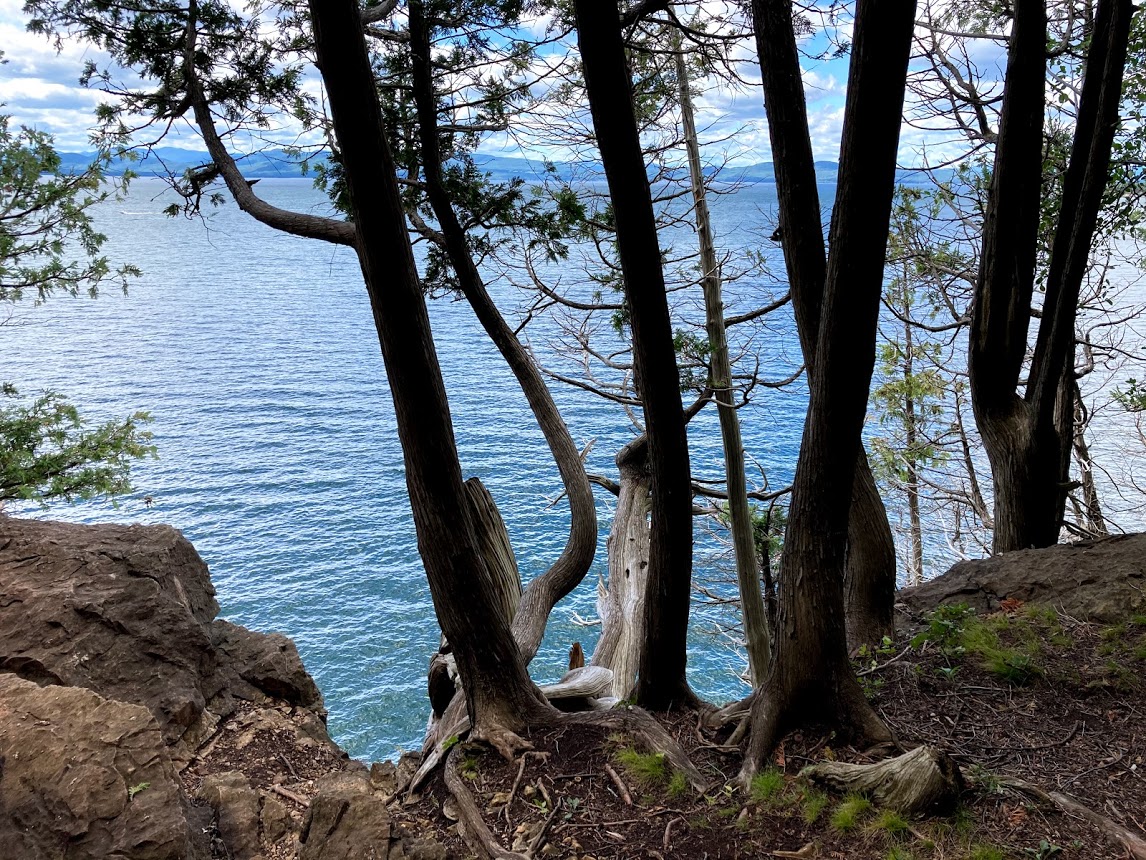
Likewise, dolostone can have profound effects on overlying or bordering communities of plants; as it weathers, it releases the calcium sequestered by ancient seashells and corals into today’s soils. Nowhere in Burlington is this relationship more evident than at Rock Point and Arms Forest, where a superabundance of rare plants (including a beautiful orchid called yellow lady’s slipper) carpet the outcrops of bedrock, and where ranks of white cedar cling to the edges of the cliffs.
Geological maps delineating these sorts of deposits can thus provide crucial clues as to what one might find on site, from rocks to flowers to trees.

Considerations of Burlington’s glacial history
But in the Burlington area, bedrock is far from destiny; soils—and surficial geology more broadly—are the ultimate arbiters of bedrock influence, in many cases eclipsing or otherwise mediating access to water and these bedrock nutrients. And this far north, any discussion of surficial geology is really a discussion of glacial history. It’s crucial to note that when the Laurentide ice sheet finally retreated north of the Quebec border about 13,200 years ago, nothing had been spared; not a single mountain had crested the miles thick glaciers; no soils were durable enough to withstand the inexorable flow of ice–in fact, meters of rock had been scoured from the landscape; no animals or plants had survived.
The retreating glaciers, however, loosed meltwaters, and these in turn laid down the rubble that constituted the new soil. This rubble occurred in all different sizes–everything from boulders to sands to micron-sized clay– and as it was swept over the landscape—where it pooled, eddied, or met large bodies of water—rubble accreted and settled out in patterns still recognizable today: the faster the flow, the larger the particle that could be carried; while conversely, only still waters would allow the tiniest clays to settle.
As the glaciers retreated northward, meltwaters pooled in the Champlain Valley, their surface reaching roughly 500 feet overhead. It was during this period that the rich clay and silt deposits accumulated on the ancient lake bottom, today among the highest valued agricultural lands in the state, examples of which are found in the Intervale and the South End. But when the ice dams to the north finally broke, the ancient lake emptied into the Atlantic in matter of hours, roaring out the St Lawrence River valley; but at this time the surrounding land was so compacted by the weight of the glaciers, it was in fact below sea level. And so as this massive lake rushed out, the Atlantic rushed back in. For between 3500 and 4500 years, the Champlain Valley was turned an estuary of the Atlantic known as the Champlain Sea, complete with Beluga whales, harbor seals, dune grasses, and beach pea.
Burlington sits exactly where the ancient Winooski River emptied into this Champlain Sea. The enormous deposits of sand and silt on which the city was built are the remnants of this ancient delta, where the torrent slowed and sediments dropped out. Today, these deposits are seen clearly in sites like Starr Farm, Centennial Woods, and Sunny Hollow in Colchester–here, the soils can be near a hundred feet deep in places, and thus totally independent of bedrock influence. They support vastly different plant communities dominated by pines and blueberries. Communities that are well-suited to the dry, nutrient poor conditions of such well-drained soils. Communities that look nothing at all like those clinging to the bedrock just a few miles away.
Shifting upward
Far from providing an iron-clad set of rules for reading the landscape, these geological considerations interact to seed the endless variation we find in Burlington today. In part two of this article, we will continue our exploration above-ground, connecting these themes and patterns to the rich cultural history here, and to the fascinating variety of plant and animal life.
About the Authors
Chris Ajello is a graduate student in the UVM Field Naturalist Program. Alicia Daniel is a Field Naturalist for Burlington Parks, Recreation and Waterfront and Executive Director for the Vermont Master Naturalist Program. Thank you to Stephen Wright for consulting on the geologic part of the story.