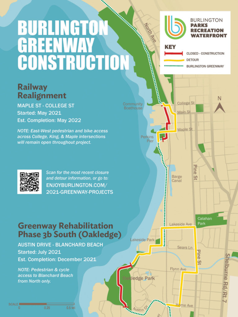
2021 Greenway Projects
This is the page info about the construction updates affecting the Bike Path for the 2021 construction season.
View the interactive map for current conditions.
Wondering about the Greenway conditions in Winter? Find the updated status here. Also available there is a link to our plowing policy.
Background: Essentially there are three projects in two locations that will be happening during the summer of 2021 through December. Concurrently, at the Waterfront, there is the Rail Realignment project managed with VTRANS and DPW that will bring AMTRAK passenger rail service back into Burlington; this is combined with the Greenway realignment that is shifting the Path to west side of the new tracks. At the south end of the Greenway, BPRW will be starting Phase 3b of the Path Rehabilitation through Oakledge. Read on below for more details about the closures and project status.
Jump to the latest updates about:
Path Rehab Project in Oakledge Park
Greenway in Oakledge has re-opened!
On a windy and warm Thursday December 16, 2021, crowds gathered to celebrate the completion of the major work in this section of the Greenway. Read the press release here.
Update 12/12
THE OVAL HAS LANDED
The final connection in the rehabilitation of the Oakledge Park portion of the Greenway was installed today and will receive some finishing touches over the weekend and on Monday. The ‘Oakledge Oval,’ a broad circulation hub, entrance and pause place, was poured on Friday morning. This ties together the entirety of the Burlington Greenway within the park, and also marks the completion of the last significant portion of the seven-year overhaul of Burlington’s beloved multi-use path.
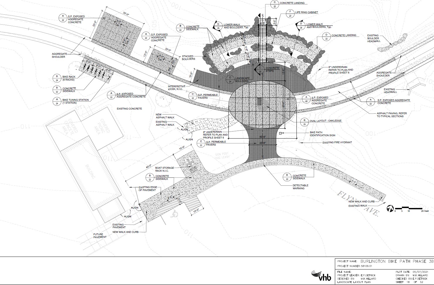
The design acknowledges and embraces the crowded confluence during during peak summer season. Emphasizing universal accessibility, the generous mini-plaza/roundabout provides ample space for the wide variety of park users to pass through the space in all directions. The Oakledge Oval also serves as the upper-level landing of an extensive universal beach access system of concrete ramps and stairs.
Together, these facilities were built with resiliency and ecology in mind. The stairs and ramp system replace a failing concrete block wall that created a 6’ drop to the beach with a treacherous and eroding path off to its side. Giant quartzite boulders, matching the native red rock of Oakledge, were used to create natural, outcropping –like shore protection. The irregular surface and porous backfill are designed to ameliorate the impact of crashing waves. All of the concrete on the lake side was poured extra thick to act as another layer of reinforcement from the impact of water and ice. Further up and surrounding the structure, native plantings help to bioengineer the slopes. And finally, the path itself was raised more than a foot in this area, with reinforced edges, to minimize the lake’s potential impact on this previously precarious stretch of the Greenway.
BPRW will celebrate the re-opening of the Oakledge portion of the Greenway next Thursday, December 16 at 3:15PM, beginning at the other oval in Oakledge, the Austin Gateway.
Update 11/9
A Successful Marathon
BPRW worked with the contractor on the Oakledge Greenway to make accommodations for Run Vermont to route their October 24th Half Marathon through Oakledge Park on the new alignment. The race course ventured north from the park, running for the first time on the much-improved sections of the Greenway including: the northern corner of the park, adjacent to Harbor Watch, Lakeside neighborhood, HULA, Barge Canal, Vermont Rail Systems and Roundhouse Park to Perkins Pier. BPRW is thrilled to provide a much-improved Greenway as a keystone of the Vermont City Marathon, not only providing a wider and more consistent surface for runners, but also creating multiple pause places and improvements in adjacent parks for spectators, and water and restroom stations, etc.
Accessibility Rising
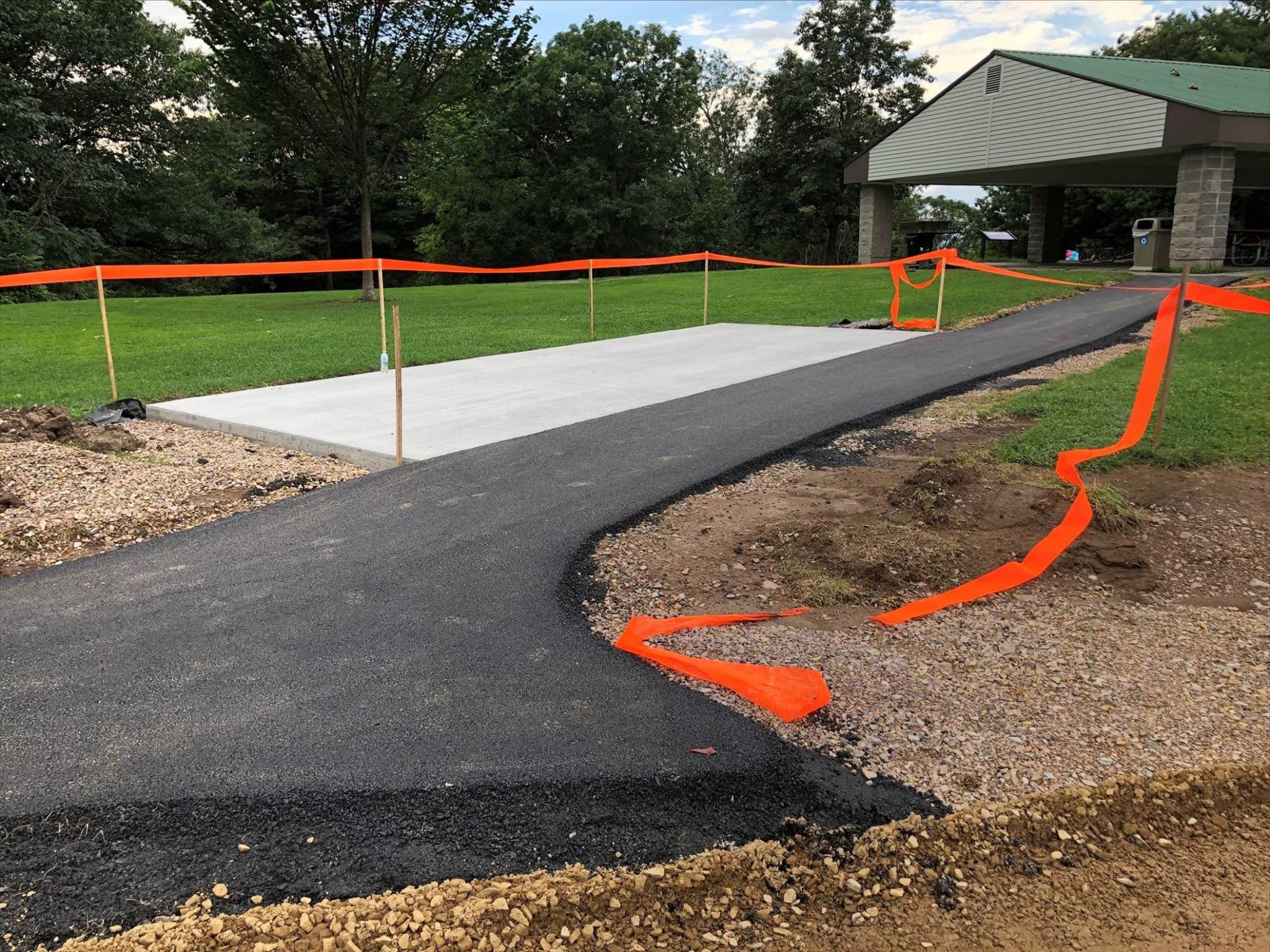
For the past several weeks, large equipment, (literally) tons of quartzite boulders, (literally, again) tons of concrete and steel, have been the main tools our contractor has used to focus on the ‘Oakledge Oval’ and Universal Beach Access. In keeping with our commitment to universal accessibility, and our focus on keeping Oakledge at the forefront of our push for inclusive outdoor recreation and social spaces, the intersection of the Greenway, sidewalk and paths from the lower pavilion at Flynn Avenue is a major gathering and transition point. When complete, the large exposed aggregate oval will act as a multi-modal roundabout of sorts, providing ample space for everyone and their respective equipment to pass through this area on their way to, well, everywhere. During major events, such as the Marathon, July 3rd, or a particularly beautiful October sunset, this will no doubt be a major gathering place for Oakledge Park lovers.
Resilience Rising
For those familiar with the problem areas of the Burlington Greenway (most have faded into history thanks to the multi-year rehabilitation project), the section of path that passes by the southern stretch of Blanchard Beach has long been damaged by high water and erosive wave action. In addition to increasing universal access, our engineers and contractor are focused on constructing this section, and its adjacent infrastructure, to withstand the increasing severity of storms and water level fluctuations. The elevation of the path itself has been raised by over a foot and the small creek flowing into the lake in this area has been naturalized. Engineering techniques utilized in the very exposed Barge Canal section have been applied to the design and construction of the universal access ramp and stairs. The heavy engineering, terraced interface with the lake and multi-layered lines of defense against the lake not only protect the structure, but also provide front line protection to the path down to the lake.
Watch the transformation!
See you in December, Winter
Barring an early start to winter, we remain on track to reopen the entirety of the Oakledge section of the Greenway in December. The complexity of the Oakledge Oval and Universal Beach Access was anticipated to require more time than other sections but the team is moving full steam ahead assembling this amazing new hub of activity. BPRW is beginning plans for a modest opening event of the path in December, with a grand opening complete with fanfare in the spring (which we anticipate will also serve as the kickoff to the long-awaited construction of the Oakledge for All Universally Accessible Playground Phase 2.
Oakledge Greenway Construction Update 9/15
There Are Two Paths You Can Go By
BPRW continues work on the Greenway with a focus on our commitment to accessibility and connectivity. This time, we are stitching together infrastructure between the new bike path alignment and the Upper Shelter at Oakledge Park. When BPRW completed a first accessibility-driven public restroom upgrade at the Upper Shelter in 2015, the project scope required that the interiors and the adjacent walkways around the building perimeter meet American with Disabilities Act (ADA) standards. Now the connection is seamless between the parking lot and the building, as well as the Greenway itself.

The Oval Team Has Arrived
Meanwhile, at the other end of the project, work has begun on what is certain to be a future Greenway landmark: The Oakledge Oval and Universal Beach Access. This week saw the removal of the last remnants of the original path in the South End.
The beach sand in the project area, which could potentially contain a seedbank of rare or threatened plant species, has been carefully removed and set aside. At project’s end, if nature hasn’t already coaxed the seeds to establish themselves, the contractor will return the sand to the vicinity of where they were removed to encourage re-establishment.
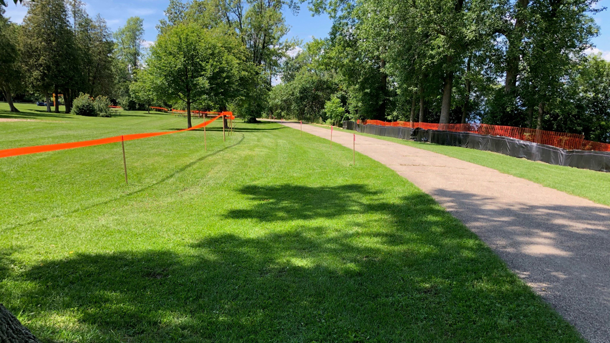
With the beginning of this intensive and concentrated work, access to Blanchard Beach from Flynn avenue is closed. Connections east-to west throughout the park are being kept open, with a few short term exceptions, to provide access to well-loved amenities to the west of the path in the southern portion of the park (Cove Beach, Treehouse, Warren’s Woods, etc.). Blanchard Beach can be accessed from the north via the Greenway south of the Lakeside Neighborhood (via Proctor Place). We thank you in advance for your patience as this important section of the Burlington Greenway is advanced, with a view to reopen at the end of the year, and ask that you stay safe and be smart in construction zones and out of fenced-off areas.
9/3 update
DING, DONG, THE BLOCKS ARE GONE
And will be put to good use at Leddy
As the final 2000’ of Greenway is finish graded and prepped for a base course of asphalt in the first part of September, our contractor is preparing for the construction of the Oakledge Oval and universal beach access ramp and stairs where Flynn Ave meets Blanchard Beach. This will replace the concrete waste block wall, which was removed on Tuesday and will be repurposed at Leddy, where our Grounds Maintenance and Trees & Greenways teams will use them to build bulk material bins. When work on this busy and complicated confluence began in earnest after Labor Day, access to the Greenway north of Flynn will be closed. Access to Blanchard Beach and other facilities in the northern section of Oakledge will be via the Greenway from the Lakeside neighborhood. Beach users will need to use the Cove.
8/24 Update:
Around the Oaks and Through the Woods
Last Segment of Greenway Rehabilitation Making Its Way to Blanchard Beach
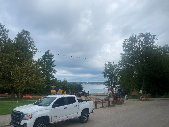
BPRW’s contractor is making great progress on Phase 3b South through Oakledge Park since starting the first week of August. Work started at Austin Drive then through the woods, before veering northwest of the old alignment to eliminate crossing the upper parking. This realignment also avoids a seasonally wet and icy section especially where the old path met the parking lot. The move northwest means the path ascends the hill at an American with Disabilities Act (ADA) compliant grade. These changes were in response to Oakledge’s popularity as a trailhead and will increase access through safety improvements and a more intuitive alignment. It is anticipated that the changes will also entice more users to the lesser-known part of the Greenway to the south and connections to South Burlington paths and destinations beyond.
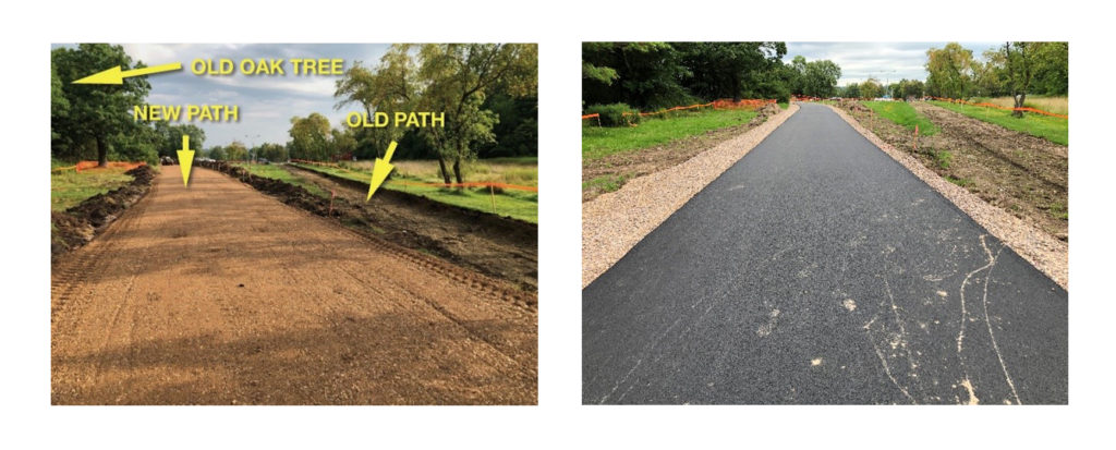
Special care was exercised as the path passed two large oak trees on its way near the highpoint of Oakledge through careful exploratory excavation work done where the path passed these two beautiful huge trees. Based on the pattern and depth of root growth, alignments were adjusted in both cases to completely avoid an older white oak south of the upper pavilion, and in the case of a somewhat younger red oak, and other healthy trees in the area north of the pavilion.
Paving of the base course (the Greenway standard is two layers of 1 ½” each) has been installed from the start of the project at Austin Drive to the south end of the upper pavilion. Access to the pavilion, Cove Beach, Warren’s Woods and the Treehouse will continue to maintained. The newly paved section of path will remain closed as our contractor begins work on the commemorative entry at Austin Drive and the universal beach access at the north end of the project near Flynn Ave. Access to Blanchard Beach and the Greenway to the north will be maintained into September. Please see our real time Greenway Detour Map.
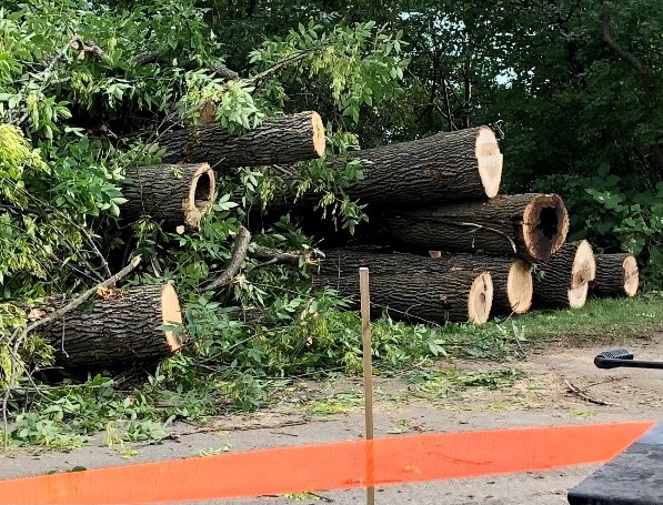
Tree removal and pruning was completed on the last stretch of phase 3b South early this week. Several medium and two large green ashes were removed from the area near the lower pavilion and the soon to be universal beach access.
In most cases, BPRW will go to great lengths to work around and save trees. There are occasions when accessibility, tree condition/viability or infrastructure damage warrant removal. In this case, it is the policy of our city arborist to remove ash from project areas as a preemptive response to the Emerald Ash Borer infestation.
BPRW thoroughly evaluated the remaining healthy and viable trees in the area. We made the decision to eliminate a paved area adjacent to the ‘Oval’ to save a robust shagbark hickory. These trees tend to be long-lived, strong-wooded trees with ranges that extend to the warmer south. Add to that a history of relatively pest-free existence means they are likely do well into the future at Oakledge.
8/11 Update: Goodbye old Path
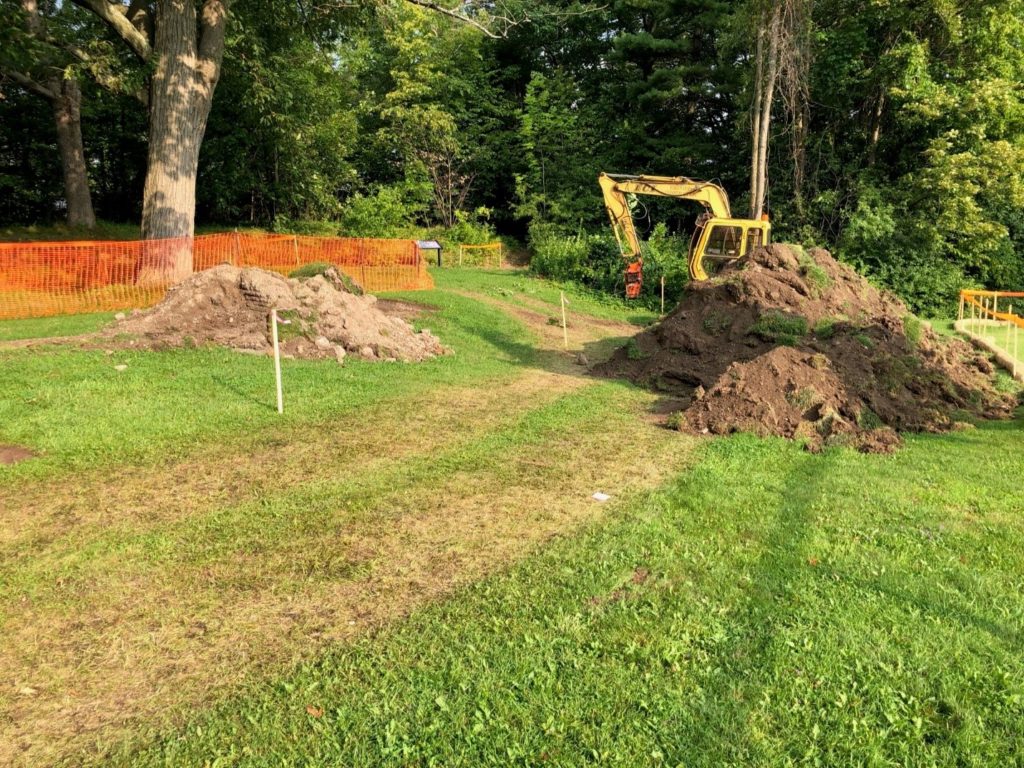
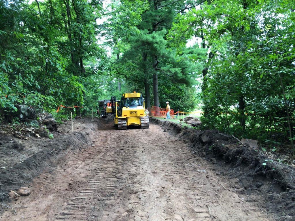
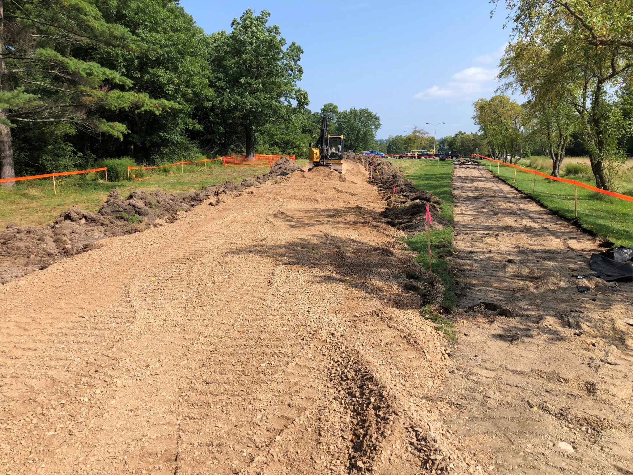
BPRW began work on the last significant section of the Burlington Greenway Rehabilitation in the southern portion of Oakledge Park last week. The multi-use path will no longer cut across the parking lot before turning west to go straight up the hill and down through the woods to the north. Instead, the path will remain entirely off street/parking lot and make a more gradual, ADA compliant climb to the top of the hill. This will keep path users safer, create better, more intuitive access for riders using Oakledge as their staging point. Contractors have been making great progress on this section of the park while preserving public access to the majority of park amenities.
We are saying goodbye to several sections of old alignment, including the recently torn up section south of the parking lot adjacent to the Upper Pavilion. The old alignment will be reclaimed (see photo below). Old subbase will be removed and used elsewhere on the project as fill . Native topsoil, now wind-rowed (center of photograph) will be used to fill the excavation, which will in turn be planted with a special blend of native wet meadow plants being developed by our Conservation team. This will expand BPRW’s ongoing rehabilitation of this area of the park since VT DEC recommended de-commissioning a flood prone softball field during the Oakledge Siting Study.
In the early fall, contractors will begin building the universal beach access and ‘The Oval,’ a multi-directional hub at the intersection of the path and Flynn Ave. that will create much more space for walkers, bikers, paddleboarders, canoers, etc. to all navigate this super busy crossroads along the bike path.
8/3 update
Rehabilitation and re-alignment of the Greenway through Oakledge Park is underway. Visiting Oakledge Park in recent days, a ‘limit of disturbance’ orange flagging tape along a significant part of the Greenway is difficult to miss! Construction crews are starting to mobilize in the northern parking lot, mounting detour signage and completing surveying. This week, the contractor will begin working on the Greenway between Austin Drive and Blanchard Beach on the southern portion of the project. To ease access to the key amenities within Oakledge, the project has been divided into three sections: Austin Drive to Upper Pavilion, Upper Pavilion to Lower Pavilion and Lower Pavilion to north of the culvert at Flynn Avenue (at Blanchard Beach). Work is beginning in the southernmost section first: from Austin Drive to the Upper Pavilion. Once this area is underway, a second crew may begin work on section 2: from the Upper Pavilion to Lower Pavilion. Work is anticipated to continue through the summer and the aim is to wrap the project up in December 2021. Please be mindful of construction signage, do not proceed through areas where the crews are working – find alternative, signed routes around to the Greenway to the north or through the park. We appreciate everyone’s cooperation and patience as we work to rehabilitate and improve this section of the Greenway.
Early Prep Work in April
Contract document development is wrapping up as we prepare to bid the rehabilitation of the Greenway in Oakledge Park (Section 3B South) out in April.
Earlier this month, our BPRW team prepared the site for the upcoming construction by selectively removed approximately 15 trees at Oakledge Park in preparation for the project. All of the larger trees, including five large green ash, were taken out in anticipation of eventual decimation by the Emerald ash borer. BPRW’s policy, as a part of the City Arborists’s EAB Response Plan, is to remove ash trees within and near project areas. Green ash are relatively short lived, weak-wooded species and these trees were beginning to show signs of decline. While preservation of healthy ash trees is possible by injecting them with insecticide every two years at a considerable cost, the decision was made to remove them because of their proximity to the lake and the playground. There were also about three medium sized maples that were dead or dying that were removed from the area of bike path construction. Approximately ten smaller trees were removed through the wooded sections of the path adjacent to the tennis courts and in the section between the upper parking lot and Austin Dr. These were deemed potential bat roosting trees that needed to be removed by the State required date of April 15 to avoid negative impacts on the nesting season for long-eared bats. BPRW is committed to replace these trees, or beyond, with a diverse planting of species native to the environment within the park. More information, will be posted here as plans get formulated. Also stay tuned for news of community members organizing events to coincide with Oakledge’s 50th anniversary this year starting with focused efforts for Green Up Day.
Background Info
Upcoming Improvements in Oakledge Park (Phase 3bS)
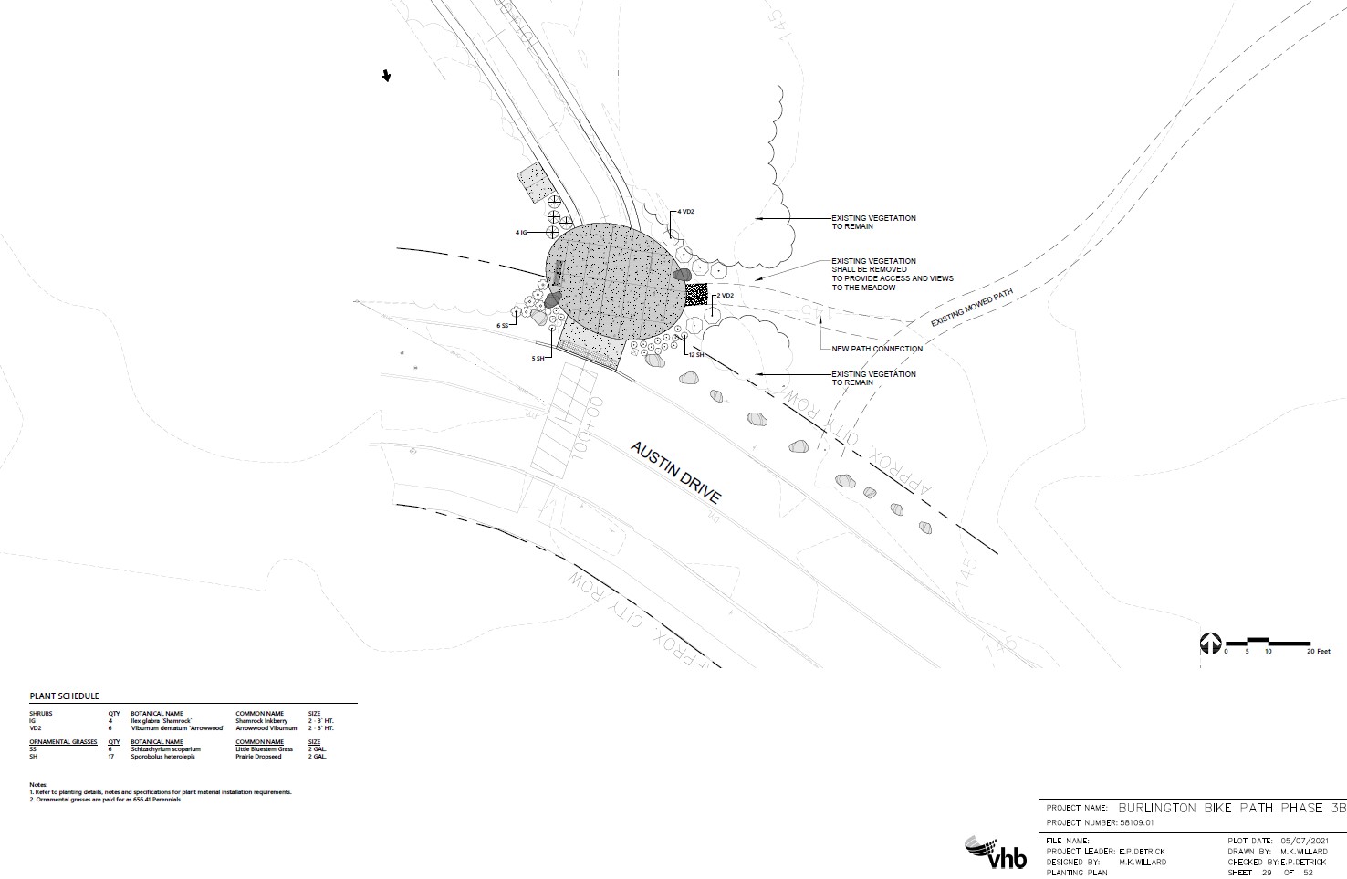
The last significant piece of unimproved Greenway in the central and southern portions of Oakledge Park will soon receive a major overhaul. Beginning in mid-July at Austin Drive, and working north as the season progresses and the crowds retreat, this last section of the 8.3 mile multi-use path will be rehabilitated. Expect the usual standard cross-section of 11’ of asphalt, 2’ gravel (exposed aggregate concrete in high traffic/erosion prone areas) shoulders on both sides, improved bike facilities and connections to existing infrastructure found throughout the Greenway. Additionally, an inviting entrance, supported in part by a donation through the Burlington Parks Foundation, will be built at the Austin Drive entry to Oakledge along with a University of Vermont Medical Center sponsored fitness station near Flynn Avenue. Finally, an expansive oval of exposed aggregate concrete and pervious pavers will provide more circulation room for the previously crowded confluence of bikers, walkers, paddlers, swimmers, etc. that cross or access the path at the important juncture at Flynn Avenue. This oval culminates in a concrete ramp which will provide urgently needed universal access to Blanchard Beach.
Previous Work (Phases 3aN, 3aS and 3bN)
Hot, dry and windy conditions have been hard on the landscape plantings at the new Roundhouse Park and additional plantings to the south. The City is working with the contractor to make sure these important green areas are well established and meet specifications before the work can be considered complete. Some of the trees that are unacceptable will be removed and replaced when weather conditions moderate later this summer into fall.
Crews have finished paving the eastern end of Harrison Avenue to make the transition from the on-street and off-street portions of the Greenway at this juncture smooth and safe. They will follow with traffic signage and pavement marking plus a convex mirror to provide better visibility to both path users and drivers in this juncture.
Finally, last fall’s work at the northern end of Oakledge Park has been accepted by the City and is looking beautiful. The wider path with shoulders, more extensive bench seating facing the lake, and a brand new arched culvert crossing of the unnamed stream near Flynn Avenue, complete with natural redrock headwall facing the lake and native riparian plantings installed by our Conservation Team with local volunteers, is a huge aesthetic and ecological improvement over previous conditions.
A safer, straighter and wider ingress and egress to the bridge over Engelsby Brook helps make the connection between the park and the Lakeside neighborhood more inviting and has also allowed BPRW maintenance crews to keep this section plowed during the winter.
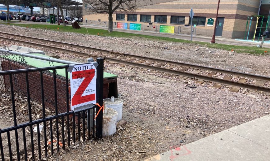
Passenger Rail Project and Greenway Realignment
Current Detours & Closures
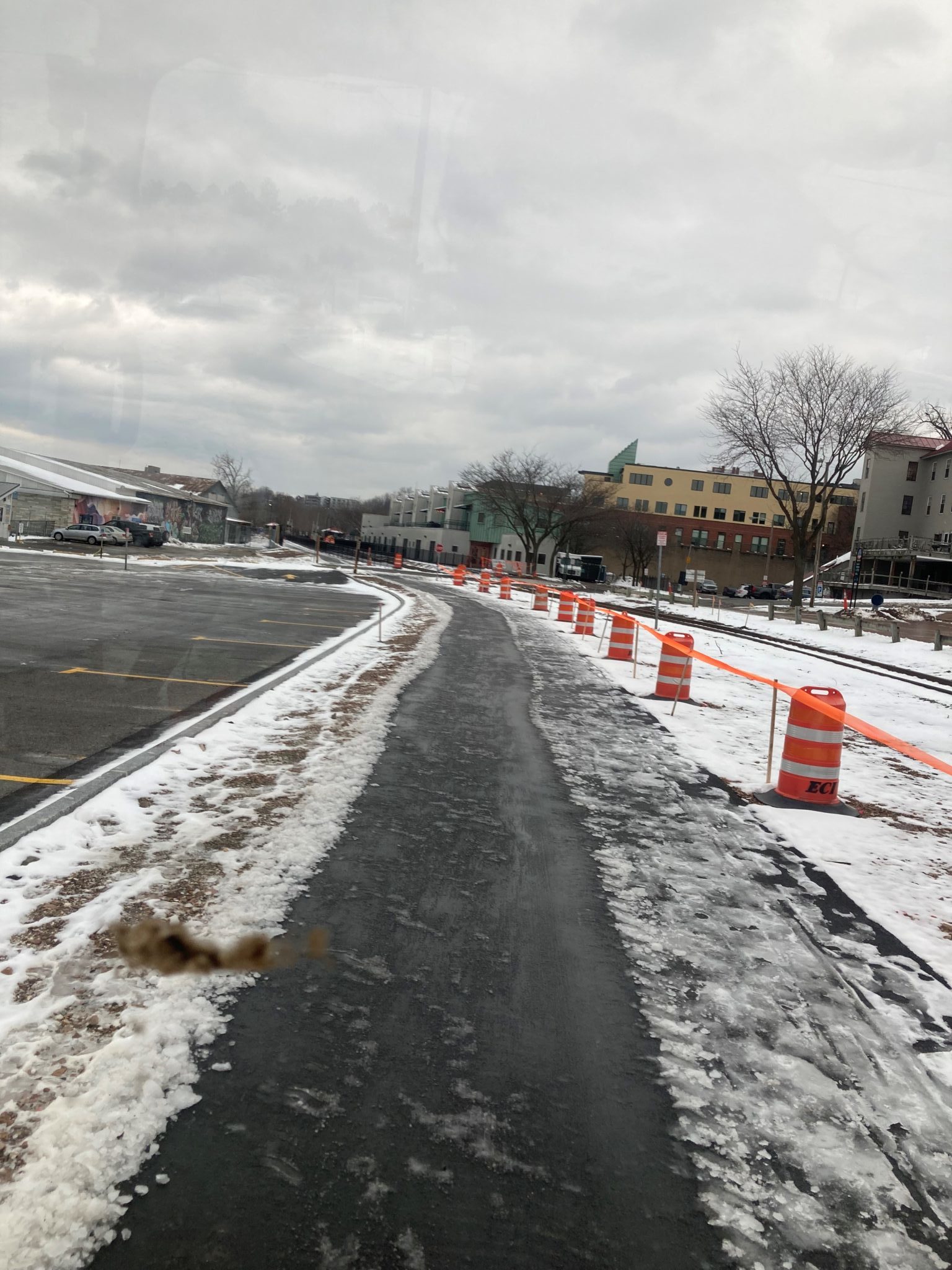
12/22/21 Update: Path Reopened for the Winter!
At this time, the newly realigned section between College Street and Maple Street is OPEN! The Path now continues on the western side of the train tracks, so no more crisscrossing over the tracks! The detour onto Battery Street has been removed. Please follow the new Path alignment through the Perkins Pier Parking lot, while work continues at Lavalley Lane.
11/12/21 Update
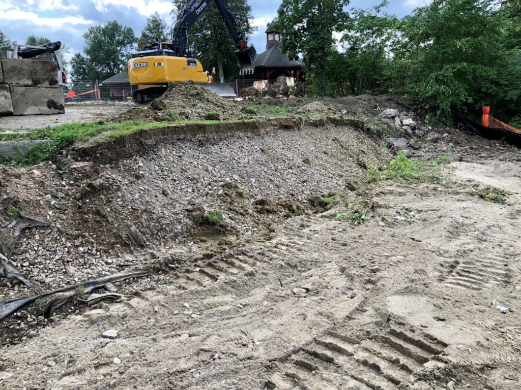
The Greenway Realignment project is progressing south. Work will start 11/12 on shifting Lavalley Lane west (into Perkins Pier) to allow the railyard to expand to accommodate passenger rail service.
As such, a long-term detour through Perkins Pier will be established starting 11/12. When traveling north, Greenway users will continue north along the shore and then head east in the delineated area through Perkins Pier to the connection at Maple to the Greenway. When traveling south, Greenway users will turn west at Maple Street, through Perkins Pier in the delineated area and then south along the shore to the usual Greenway connection. The sections of the path that run along Lavalley Lane and the southern edge of Perkins Pier with the Waste Water Treatment Plant will be closed. Work in this area is anticipated to continue for the rest of the year, with this long-term detour in place indefinitely as we wrap up the Siting Study for Perkins Pier to identify the final connection of the Greenway through the park.
Please follow the detour signs and remain vigilant around areas of construction. Please do not proceed in areas where ‘path closed’ signs are located.
The City, in collaboration with the Burlington Business Association, Local Motion, and the Burlington Walk/Bike Council have added a temporary two-way buffered bike lane on the west side of Battery St. for the King/Battery/Main/College detour.
Thanks for your patience and understanding to the businesses on the west side of Battery between Main and Maple! Remember that BPRW and DPW have created a special parking compensation program for customers of Battery St businesses. There are 8 reserved spaces at Perkins Pier and the businesses can provided special codes for two hours of free parking!
September Update: College Street Plaza and the Realignment
THE NEW DESIGNS
BPRW & DPW continue a summer of placemaking construction along the Greenway, with a total of three activity nodes strung along the southern half of the Waterfront Bike Path under construction and a fourth nearing the end of the bidding process.
In addition to the Austin Gateway and the Oakledge Oval in Oakledge Park (update above), the Amtrak/Greenway Realignment project contains the largest area of construction improvements to public spaces. The new redesign of the multi-modal hub where the bike path crosses College Street, will provide a more expansive and safer plaza-like space near popular destinations including: Waterfront Park, ECHO Museum, the Community Boathouse, the Spirit of Ethan Allen and more.
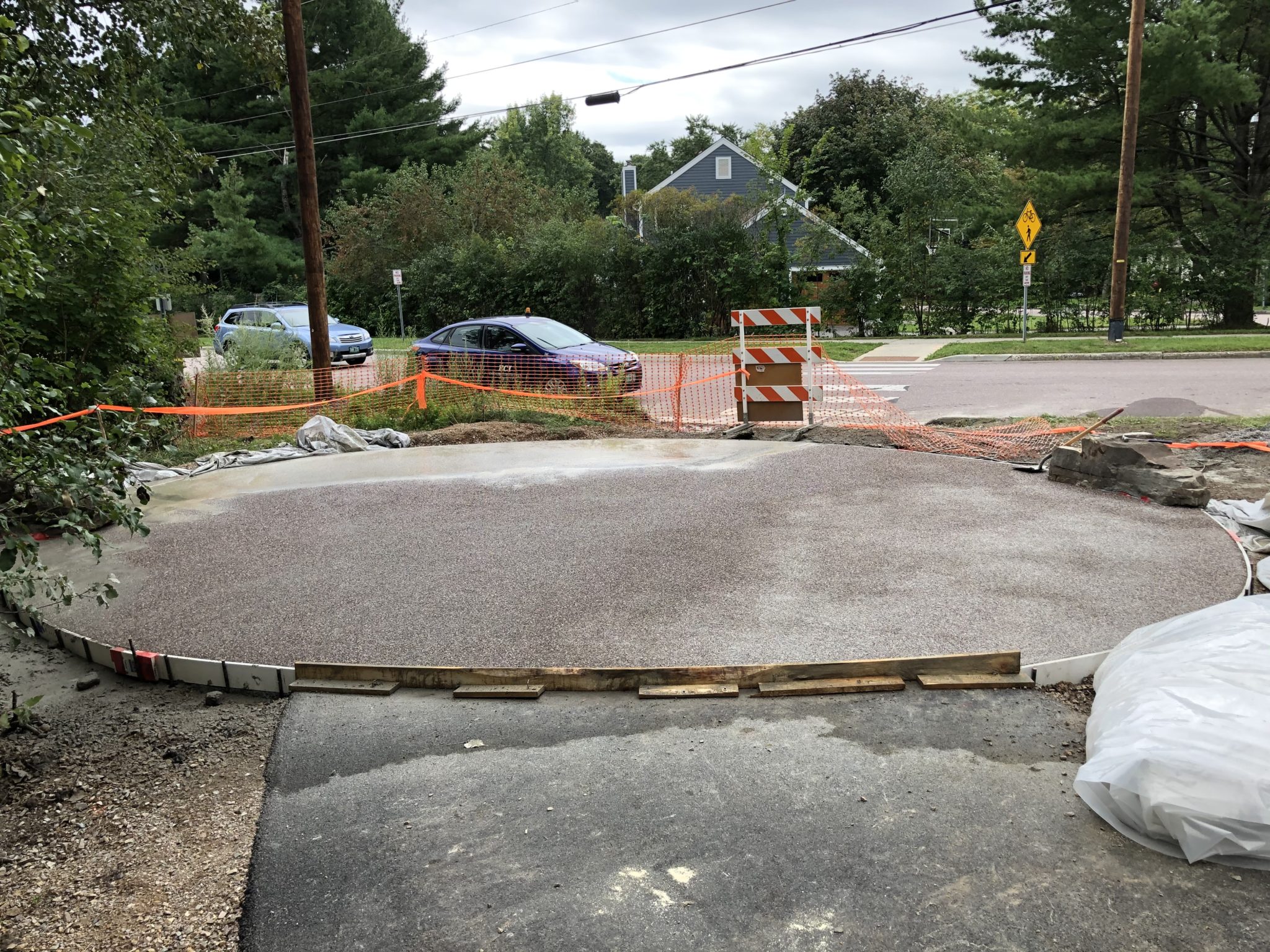
By extending the exposed aggregate concrete paving found in the ECHO entry plaza across College Street and into Waterfront Park, and as far east as the railroad tracks, a large, open table-top intersection that stands apart from the standard of the street is created. The new plaza creates ample space for pedestrians and bicyclists to travel through without interference, and without the need to cross railroad track or negotiate through the queue at the creemee stand. At the same time, the plaza is a fully functional street, allowing motor vehicles to access the entrance road to ECHO’s parking lot, and service vehicles to access the other public and private amenities that surround this vibrant hub.
CONSTRUCTION WORK CONTINUES
College Street in front of ECHO has seen a hub of contractor activity in the last few weeks. While the road is closed to vehicular traffic, crews are working on forming concrete ahead of installing pavers, exposed aggregate and granite detectable warning surfaces that will extend ECHO’s entrance into the intersection. Once the work in the road is complete, the road will reopen to vehicular traffic and the crews will continue to work outward adding in different components to the bike path realignment west of the tracks.
ONGOING DETOURS AND CLOSURES
Just like at Oakledge, creating these public spaces requires patience. To maximize efficiencies and shorten project duration, while maintaining safety, there have been two intersection closures for these projects. Currently, we are nearing the end of the second and longest full closure at College and the Greenway. By the time this intersection reopens, it will have been reborn as the College Street Plaza. Burlington, you’re going to love it!
Work between on the bike path between King and Maple Streets has also been ongoing. The contractor has realigned the path and completed a base course of paving. They have also started preparing the parking area at Perkins Pier for a traffic detour when they’ll be working on the crossing at Maple Street at the end of the month. Other changes at Perkins Pier include a long-term temporary realignment of the bike path through the parking lot and the park connecting it to the path along the waterfront. This alignment is in place ahead of the work which will be done on Lavalley Lane as part of the expansion of the railyard onto the road. The temporary long-term connection at Perkins will be in place until the results of Siting Study for Perkins Pier determines the permanent new alignment of the path in the future and when funds are secured to implement any changes.
To accommodate the railway and bike path realignment from College to Maple, a temporary protected bike detour was installed on the west side of Battery Street for the safety of users. We appreciate that this is an inconvenience to customers and owners of businesses along this stretch and are grateful for their patience as we oversee the completion of these projects.
Background
Posted 6/25/2021
The City of Burlington, the State of Vermont Agency of Transportation Rail Division (VTrans) and Vermont Rail Systems (VRS) are pleased to be underway with the long-anticipated track and bike path work to be completed prior to the arrival of AMTRAK passenger service to the Queen City.
The City’s longstanding goal of a Greenway alignment entirely west of the RR tracks from Perkins Pier to Waterfront Park, and a more recent goal of parking the passenger train in the Burlington railyard (as opposed to on the tracks between College Street and Maple Street), will both be realized when construction wraps up at the end of the year.
Features of this heavily utilized section of the Greenway include width expansion to 11’ of paved two-way multi-use path with 2’ shoulders on both sides, new landscape plantings, improved intersections, and a multi-modal plaza at the College St. crossing. The plaza, which will extend from the existing entry plaza at ECHO east to the tracks and north to Waterfront Park, will embrace the significance of this hub of vibrancy on the central waterfront as a major civic space.
Work began last fall with underground utility work at College Street, and has started staging and doing preliminary work to construct the track and bike path King and College. Pedestrian access to Waterfront businesses will be maintained throughout the project, while some interruptions to vehicular traffic will be kept to a minimum. The project is managed by VTRANS. Updates for the Rail Project can be found on their online project page (https://vtrans.vermont.gov/rail/amtrak-burlington). Questions can be directed to the VTRAN public information officer Natalie Boyle at: nboyle@eivtech.com.
Spring Update
Expect the section of the path between College and Maple Streets to remain closed. Pedestrian access to the Community Boathouse and all Waterfront businesses WILL REMAIN OPEN all season. Vehicle and parking access may be interrupted at times. We will do all we can to get the word out about disruptions in a timely manner.![]()
Click here to read the official info from VTRANS about the project
Key info:
- Expect the section of the bike path between College and Maple Streets to remain closed during Phases 1, 2 and 3
- Pedestrian access to all Waterfront businesses will remain open all season
- There will be intermittent disruptions to vehicle and parking access throughout Phases 1, 2 and 3
If you have questions, please contact Natalie Boyle, Public Information Consultant, with questions or concerns, to receive project updates and alerts, and to remain informed of the progress on the project and what to expect.
Project information from Agency of Transportation can be found on their website or their Facebook page
Pre-Construction Update
A contractor has been selected for the second phase of the passenger rail/ Greenway Realignment project (College to King Street). A third contract, for the King to Maple street section, is still out to bid until late-April. Once a construction kick-off meeting is held, VTrans will be able to provide an update on the construction schedule. In the interim, we can state that the existing detour from College to King Street will be extended to Maple Street for most of the summer once crews begin mobilizing. Meanwhile, designs are in progress for the realignment of Lavalley Lane as the railyard expands west to accommodate the overnighting train.
Ahead of construction breaking ground, tree removals will occur along the eastern edge of the ECHO parking lot and Perkins Pier. The removals will include potential bat roosting trees before the State’s Guidelines for protecting Northern Long-Eared Bat summer habitat. Six large cottonwoods and two Norway Maple will be removed to allow space for the Greenway to be located on the west side of the relocated railway tracks – a safe alignment that has been a City goal for several years. An ash tree will also be removed along ECHO’s parking lot in alignment with the City’s anticipation of Emerald Ash Borer damaging the tree and making it unsafe. Three trees along the Perkins Pier parcel were safely transplanted to the A_Dog Skatepark ahead of the Greenway construction on the eastern side of the park. In this stretch, the Greenway is located mainly within the rail right-of-way along this part of the corridor and the Greenway’s location was determined by offsets from the rail alignment and other technical requirements.
While the Bike Path is already detoured in this area to Battery Street, pedestrian access to businesses and ECHO on the west side of the rail and Bike Path will be maintained throughout the construction process. Vehicular traffic will see some impact, which will be communicated to the public ahead of time via social media, updates to our Greenway GIS Map and other outreach outlets. We are all looking forward to restoring the Greenway connection north-south at project completion and appreciate everyone’s patience as we navigate a busy return-to-a-normal summer and a major construction project that will enhance this part of the Greenway and City once complete.