McKenzie Park
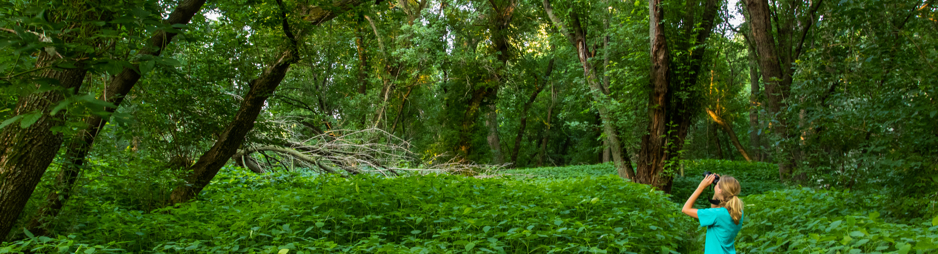
One of the most dynamic parklands in the Champlain Valley is tucked along the Winooski River between the Ethan Allen Homestead and the Intervale agricultural fields. Dewy ears of sweet corn hang over the edge of a dirt bike path. Mink and otter tracks meander around the river’s edge. Orioles and goldfinches sing at the forest edge above juicy blackberry bushes. McKenzie Park’s rare sandy shores, cathedral-like riverside woods, and historic farmlands are an ideal place to retire from the hustle-and-bustle of downtown Burlington. Park visitors will find themselves immersed in stories of human heritage, rich ecosystems, and powerful natural processes.
A River-sculpted Ecology
The lush, open floodplain woods of McKenzie Park are unlike most other forests in Vermont. Natural floods annually scour the forest floor with rushing water, ice, and floating debris. The frequency and intensity of these powerful events prevents all but a certain suite of flora from growing. Towering overhead are old silver maples, evolved to grow quickly (nearly 3 feet per year) and establish deep, stabilizing roots that withstand seasonal flooding. A century of ice abrasion carves deep scars into the bases of the largest maples. Chest-high seas of jewelweed and wood nettle grow in the summer shade of the maple canopy. These annual wildflowers grow prolifically in the exceptional soils deposited by the floods, and easily colonize the ground exposed in these disturbance events. Since little other vegetation can establish in these forests, visitors are treated to a cathedral-like experience, with arching maple boughs intertwining high above a dense carpet of forbs and ferns.

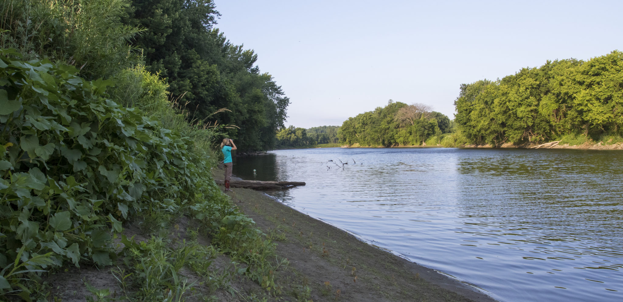
The river’s edge boasts one of Vermont’s most uncommon and sensitive natural communities. Though a sandy beach may not initially strike the explorer as a candidate for Vermont’s rarest of features, there are few other places where sandy river edges remain undeveloped and undisturbed. In this zone of the river’s most intense water and ice abrasion, even floodplain-tolerant species like silver maples are quickly destroyed. Yet rare and specialized grasses and sedges thrive along the sandy shore. These paradoxical plants are easily trampled by dog-walkers and fishermen, but evolved to eke out a tenuous existence in the face of frequent and intense natural disturbance. Explorers enjoying this beach are therefore encouraged to keep off the grass while enjoying the diving kingfishers, sprightly beavers, and the peaceful flow of the river that both creates and destroys McKenzie Park’s dynamic ecology.
Flowing Through Time
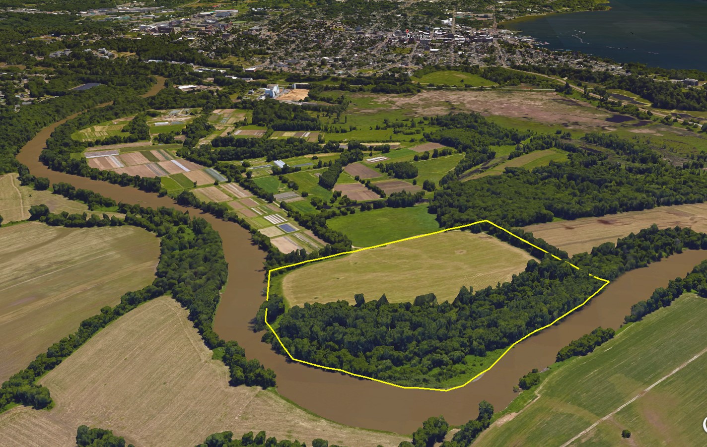
Beneath the floodplain forest, the historical movement of the Winooski River sculpts every corner of the surrounding landscape. A much larger Winooski River once flowed out of the Green Mountains following the retreat of the glaciers 14,000 years ago. During this period, the river emptied into glacial Lake Vermont, and later the Champlain Sea, depositing massive amounts of sediment at its prehistoric mouth in a giant delta encompassing much of today’s Burlington, South Burlington, and Colchester. As the Champlain Sea receded over time into modern Lake Champlain, the dwindling Winooski River carved and meandered down through its old delta, creating today’s Intervale (a term referring to the rich lowlands between hills). Standing at the edge of the Winooski River, explorers look across McKenzie Park toward the upland plateau of Burlington’s North End, and imagine the river slowly excavating this entire landscape over the ages. The current river course is just a snapshot in the evolution of this living, evolving floodplain.
Though the Winooski sculpts its floodplain and inhabitants over millennia, drastic changes can happen within human lifetimes. Surveys up to 1890 show the river channel running through the western edge of the park, directly bypassing the meandering loop that bounds the park’s shore today [1]. By 1913, however, the river had abandoned that corridor and settled into its present channel along the park’s eastern boundary [2]. Originally part of Colchester, McKenzie Park was scooped up by this new meander, situating it squarely on the Burlington side of the river. Thanks to this variable boundary, the land under McKenzie Park immigrated to Burlington just a century ago!
The Original Burlington
A major travel corridor, the Winooski connected Native American communities upstream in the Green Mountains all the way to Lake Champlain. The name Winooskiok translates to “the beautiful river along the land of onions.” It was also the name of the Abenaki village along the shores surrounding McKenzie Park. From Winooski Falls through the Intervale, Winooskiok was the heart of Abenaki civilization in the Champlain Valley long before Burlington ever appeared on a map [3].
Listen to hear Abenaki use of the Intervale region around McKenzie Park. Voice of Charles Delaney, Abenaki leader and Burlington resident. Former Chair of Vermont Commission on Native American Affairs.
At this familiar fishing ground, Abenaki communities built weirs across the Winooski to trap and propagate fish. Once dried, the fish were traded as a commodity, and their prolific harvest enabled a year-round Abenaki population to thrive. Beyond the riverbanks, the same fertile soils enjoyed by farmers today were used by Abenaki for growing staples like squash, corn, and tobacco. Surplus fish were composted and added to the soil to supplement its already-exceptional fertility. The community dwellings moved across the floodplain, alongside the migrating river channel [3,4]. “If you came here, you had friends and family…there was always a place for you, and that’s why people gravitated here. That McKenzie Park, and that area down there, was the original Burlington [3].”
The land-clearing forces of the powerful river buried or destroyed most evidence of Native American presence in the Intervale. Over the last 200 years, farmers routinely turned up projectile points while tilling their fields. These plow-zone artifacts, buried within a few feet of the surface, are often as much as 1,500 years old. But the perpetual sedimentation from the Winooski River buried the region’s oldest artifacts even deeper [4]. Excavation projects penetrating deep through the floodplain soils have turned up flakes, shards, and even human remains over 4,000 years old [5]. A visitor to McKenzie Park can imagine traveling deeper into the past with every shovel of earth, eventually uncovering the soil walked by Burlington’s earliest paleoindian communities.

European Contact
Colonial settlers dramatically changed the natural and cultural landscape of the Winooski and its floodplain throughout the 18th and 19th centuries. Many of Burlington’s first colonists, lauded for “improving” the area, were responsible for eliminating the Abenaki presence on the landscape. Native communities were determinedly driven and exterminated from the region to facilitate European settlement. Abenaki land use traditions suddenly surrendered to European-style rectilinear property boundaries and ownership laws.
In Ira Allen’s original survey of Burlington, he designated the town’s first 40 lots in the Intervale, recognizing the area’s prime agricultural potential. Each property contained long, thin 100-acre lots of fertile soils, each with a section of river frontage for easy access. In these early settlement years, rivers were often the most reliable means of transportation. Abenaki farming traditions were replaced with gridded plowed fields of barley, wheat, rye, and corn. The floodplain forests were harvested for lumber and potash, and the cleared land became cropland or pasture for cows and swine [6]. Visitors will notice abrupt divides between rectangular cultivated farmlands and old floodplain forests, a cultural imprint of this conversion from native to colonial land use. Discerning explorers may even notice the long ditches through the woods, perpendicular to the river, revealing evidence of farmers draining annual floodwaters from their cornfields well into the mid-20th century [7].
Other impacts of European colonization in the Intervale came from further afield. The wholesale logging and clearing of forests across Vermont in the early- to mid-1800s exposed thousands of square miles of bare earth. Major erosion followed, washing Vermont’s topsoil into the Winooski in an episode approaching the Dust Bowl in severity. Nearly ten feet of the soil underfoot at McKenzie Park originated from this early-19th century erosion event [8]. With the magnitude of sand and silt re-depositing into banks and berms throughout the floodplain during this time, the Winooski River re-drew its course, finding new paths-of-least-resistance. Compounding this, few stabilizing tree roots remained in the Intervale after colonial conversion to agriculture, so the river had little trouble carving new channels through its floodplain.
In one step, visitors of McKenzie Park walk on the heritage of both Burlington’s youngest earth and its oldest stewards. The exceptional soil, the floodplain forest, the generations of farming, and the millennia of human connection with this landscape is all part of an evolving tapestry painted by a single river.
Written and compiled by Sean Beckett and Samantha Ford in partnership with Burlington Geographic. Contact PLACE@uvm.edu with questions and inquiries related to this research.
Reference:
- Hopkins, G.M. Map of the city of Burlington, Vermont. 1890. Available at http://cdi.uvm.edu/collections/index.xql
- U.S. Geological Survey. Topographic Quadrangle Map of Milton, VT. 1913. Reston, VA. Available at http://historicalmaps.arcgis.com/usgs
- Charley L. Delaney, former Chair of the Vermont Commission on Native American Affairs, Personal Communication, July 2016.
- Thomas, P. A. and P. Doherty. Archaeological Resource Management Study: Lower Winooski River Watershed. Department of Anthropology, University of Vermont, 1981. Report # 37.
- Thomas, P. A. and B.S. Robinson. Joseph C. McNeil Generating Station: Borrow Area. Archaeological Evaluation. Department of Anthropology, University of Vermont, 1981. Report # 31.
- Intervale Center, The. The Old Intervale. Kenneth Peck Studios, 2003.
- Carlson, B. McKenzie Property Inventory, Assessment, & Management Plan. Winooski Valley Park District, 2003. Available at: https://www.burlingtonvt.gov/sites/default/files/PZ/OpenSpaceProtectionPlan/McKenzie%20Management%20Plan.pdf
- Reno, R. The Burlington Intervale. An Intervale Community Farm Publication, 1993.